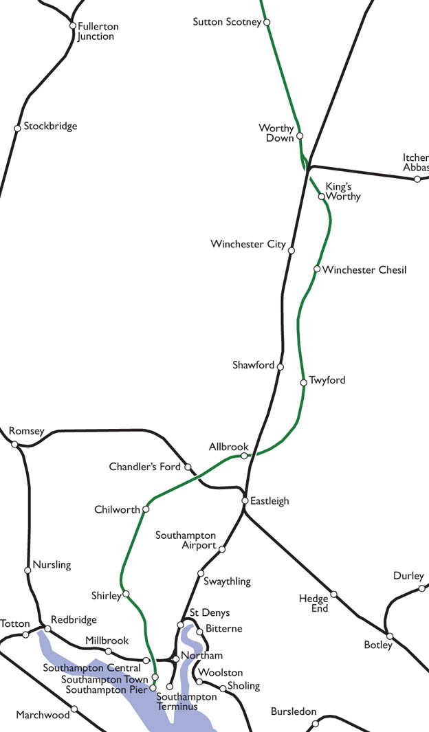
THE ROUTE
South from Chesil Station along the route of the eventual Shawford link, until just before the viaduct.
Along the east side of the Hockley to Twyford road.
East around Twyford, into Twyford Station, and along the east side of Bourne Lane.
Across Hare Lane
Across Main Road, and through what is now Colden Common, crossing the junction of Spring Lane/Upper Moors Road/Lower Moors Road.
Across the main railway line, at a point just south of Highbridge Road, to Allbrook Station.
West across what is now the M3 and Oakmount Road and just north of the site of Toynbee School.
Across the Romsey-Eastleigh railway line.
Through Chandler’s Ford, passing Bournemouth Road at the Leigh Road junction.
South West through Hut Wood, to Chilworth Station.
Through the current M27, into a tunnel under Chilworth Common.
Through Southampton Golf Course into Lordswood.
Under Winchester Road just west of its junction with Wilton Road into Shirley Station.
South east running between Wilton Road and St James Road.
Under Hill Lane into a goods station on the site of The Dell football ground.
Over a viaduct crossing the existing railway at Southampton West/Central Station.
Alongside Western Esplanade, through what is now WestQuay, to Southampton Town Station at the west end of Bargate Street.
Down to Southampton Pier Station.